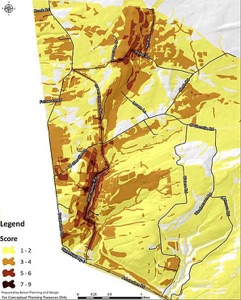
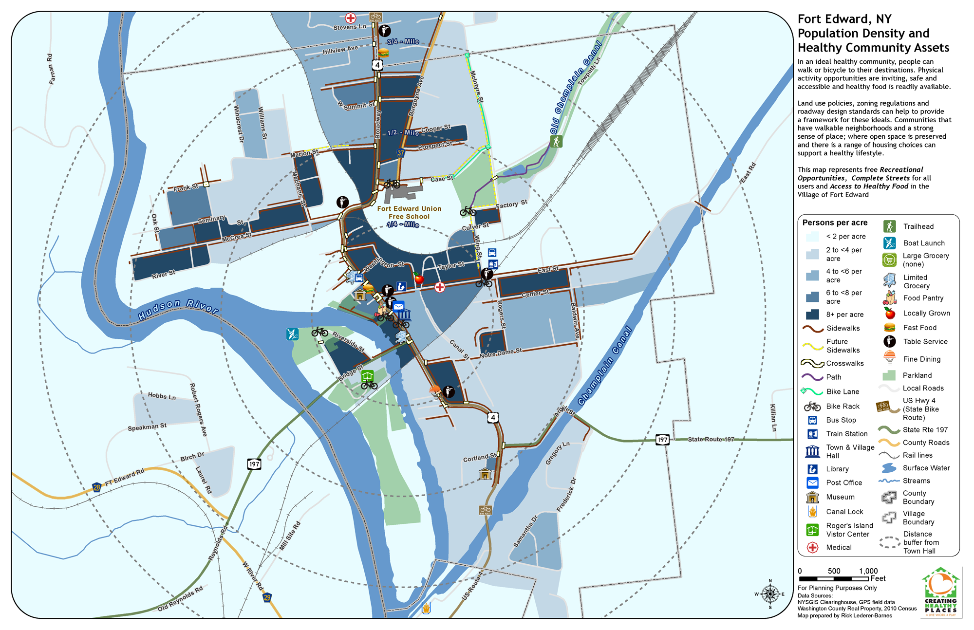
In 2013 Rick created a series of maps for the The Health Promotion Center at Glens Falls Hospital in support of the Creating Healthy Places to Live, Work and Play program.  Recreational Opportunities, Complete Street Assets, and Access to Health Food were mapped in the Town of Warrensburg, NY and the Village of Fort Edward, NY.  Several new datasets for Healthy Community Assets were created as part of this project. By looking at the assets in relation to population density, an evaluation was made as to what areas may be underserved. The project was renewed in 2014 to study the Town of Chester and Village of Hudson Falls, NY.


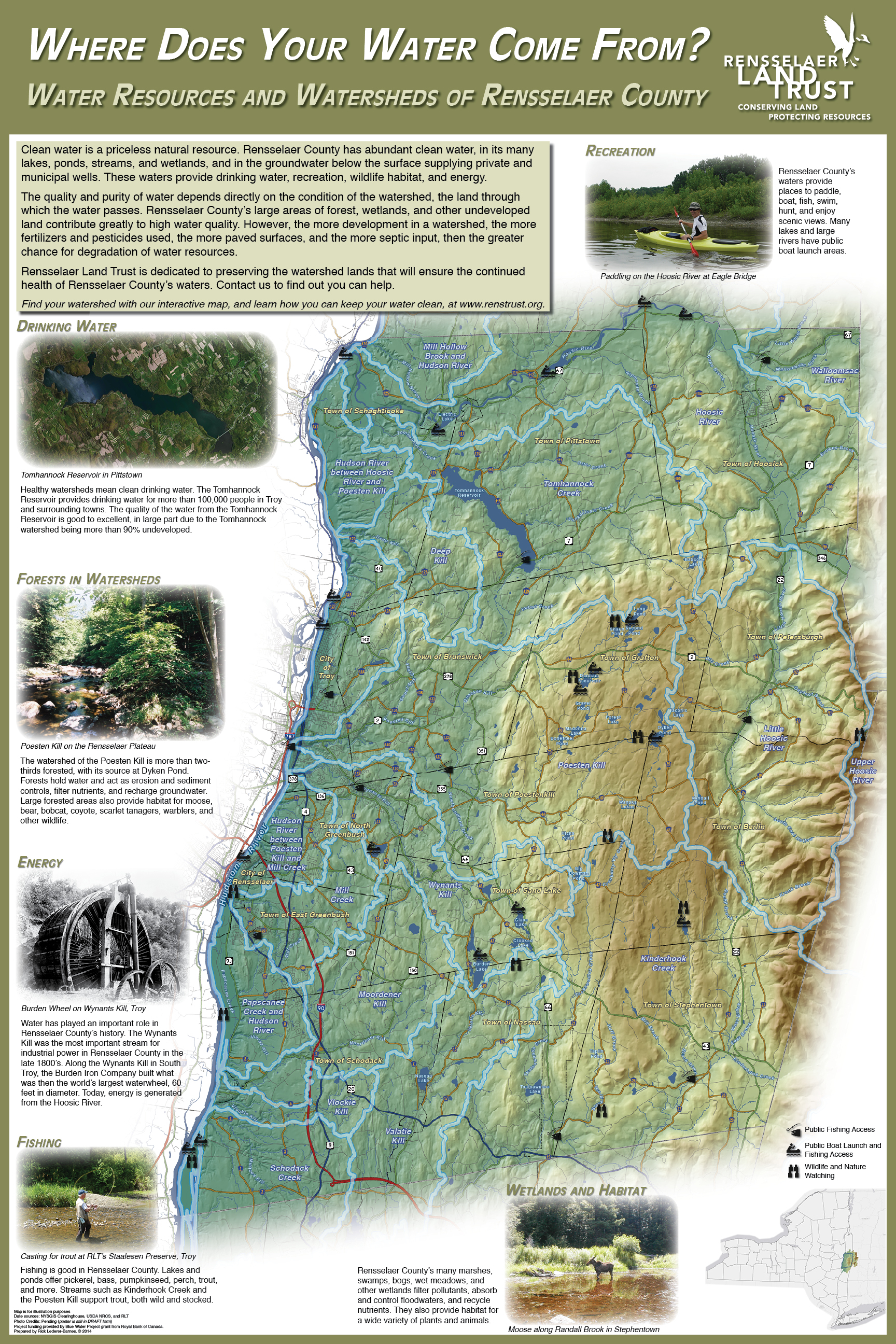
In the Spring of 2014 Rick completed an interactive watershed awareness map and informational poster for the Rensselaer Land Trust. These products focus on watershed education for the general public and highlight where drinking water comes from and the environmental and recreational benefits of the county’s water.

The Mohawk Hudson Land Conservancy (MHLC): GIS Analysis to Facilitate Strategic Land Acquisition Planning is an example of a GIS project managed by Rick while at Behan Planning and Design. The project involved creating a spatially based prioritization strategy for four areas within the MHLC’s service area.  This prioritization allowed the MHLC to focus their conservation efforts moving forward. The process and results of the analysis were presented at the annual Northeast Arc User (NEARC) Conference in 2011. The map at right is an example of one of the priority rating maps - used with permission, courtesy of Behan Planning and Design.


Other recent projects include providing mapping and data analysis to the Chazen Companies for dozens of projects, including the recently completed Lake George Watershed Data Atlas, assisting MJ Engineering with The New York Rising Community Reconstruction Program for several counties in New York, creating a simple GIS for Roohan Realty to use for in-house mapping, and creating maps and slides for the Battenkill Conservancy’s Corridor Connections Project.

While at Behan Planning and Design Rick was the project manager for the Town of Charlton Farmland Protection Plan. Rick wrote the grant application that ultimately resulted in funding for the project, managed all aspects of the project including organizing and conducting committee meetings, focus group meetings, and a public workshop, completed a comprehensive inventory of agricultural resources, authored the plan, completed required SEQR forms for adoption, created a summary brochure, and assisted the town begin implementation of one of the first municipal farmland protection plans approved by New York State Department of Agriculture and Markets.

Project Experience


Rick has managed numerous projects throughout his career and has assisted with more than 60 planning and design projects over the past eight years. The following are just a few project examples: